Cape Town International Airport (CPT)
Driving Directions / Travel by Car
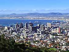
(Cape Town, Western Cape, South Africa)
Easily accessible via the busy N2 national road (Settlers Way), Cape Town International Airport (CPT) is located 25 km / 15.5 miles east of Cape Town city centre.
Driving to the airport from the city centre takes approximately 20 minutes.
On the eastern side of Cape Town Airport, the R300 runs in a north / south direction, while the M12 (Stellenbosch Arterial Road) is also nearby, to the north, and links both the M10 and the R300.
Directions to Cape Town International Airport (CPT) from the city centre:
- Follow either the Eastern Boulevard or the De Waal Drive from the city centre
- Feed onto the N2 from either route
- Follow signs to the airport
Directions to Cape Town International Airport (CPT) from the southern suburbs:
- Follow the M5 from the southern suburbs
- Take the N2 turn-off
- Follow signs to the airport
The N2 is a busy national road and one of the major routes connecting Cape Town city centre with its outlying areas. Although it sees a steady flow of traffic at most times, peak hours are generally congested and unusual occurrences such as accidents can cause traffic to be backed up for miles. For this reason, it is always advisable to allow yourself extra time to reach Cape Town Airport.
The N2 is also known as a high crime risk route and drivers should avoid stopping unnecessarily along the way, particularly at night.
